Hansebelt
Gewerbeflächen im Hansebelt
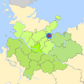
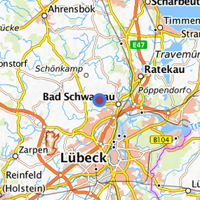
Bad Schwartau Langenfelde Nord (Flurstück 1481) at Bad Schwartau, Kreis Ostholstein

Legend
Availabilities
Immediately
short term (2 years)
medium term (2-5 years)
long-term (> 5 years)
optional area (bindingly reserved)
occupational pension plan
not available
Brief description
Description of the parcel
Bad Schwartau Langenfelde Nord
Municapility/city
Bad Schwartau
Parcel
Property size (m²)
13,021
Availability
immediately available
focus use
building stock
further use
building stock
Legal planning situation
Commercial space secured by planning permission
Yes
Building area according to land use plan
commercial building area
Existing planning law
§30 BauGB (qualified development plan)
Type and extent of building and land use
Specific type of structural use
GE
Development situation
fully accessible
24-hour operation
Not specified
possible site occupancy ratio
0.8
possible floor area figure
No information
possible number of full floors
No information
possible height of building structures
No information
cubic index
No information
Exclusions/restrictions of land use
restrictions to mobilization
Not specified
Infrastructur of site
broadband availability (at least 50 MBit/s)
Yes
quay edge
No
quay edge with sea-going vessel deep water
No
direct rail connection
No
electricity connection
Yes
gas connection
Yes
water connection
Yes
wastewater connection
Yes
Proprietary situation and marketing intention
proprietary situation
Public
Detailed information about commercial zone
Gross surface area (ha)
7.2816
Sector focus
mixed sector structure
Type of location of commercial estate
classic commercial estate
Transport accessibility
Motorway
A 1
3.7
km
Motorway
A 226
5.8
km
Motorway
A 20
11.5
km
Motorway
A 21
31.0
km
Motorway
A 24
47.6
km
Main road
B 75
8.5
km
International airport
Flughafen Hamburg
63.3
km
International airport
Flughafen Rostock
120.4
km
Regional airport
Flughafen Lübeck
15.7
km
Regional airport
Schwerin-Parchim
112.5
km
Commercial airfield
Hartenholm
47.1
km
Commercial airfield
Neumünster
59.6
km
Commercial airfield
Wismar
66.4
km
Commercial airfield
Hungriger Wolf
84.5
km
Commercial airfield
Uetersen/Heist
89.0
km
Port
Port of Lübeck
6.6
km
Port
Gewerbehafen Neustadt i.H.
26.4
km
Port
Binnenhafen Mölln
37.6
km
Port
Gewerbehafen Heiligenhafen
61.9
km
Port
Seehafen Hansestadt Wismar
64.3
km
Rail freight traffic
Lübeck Nordlandkai (trimodal)
7.2
km
Rail freight traffic
Lehmannkai 1 (HL)
7.9
km
Rail freight traffic
Lübeck Konstinkai
8.6
km
Intermodal terminal
Cargo-Terminal Lehmann (Lübeck, trimodal)
9.5
km
Intermodal terminal
Baltic Rail gate (Lübeck, trimodal)
14.7
km
Intermodal terminal
Terminal Neumünster
58.7
km
Rail passenger transport
Bad Schwartau
3.2
km
Rail passenger transport
Lübeck-Dänischburg Ikea
5.9
km
Rail passenger transport
Lübeck Hbf.
8.4
km
Rail passenger transport
Pansdorf
9.6
km
Rail passenger transport
Lübeck-Kücknitz
11.6
km
Public transport
Bad Schwartau Rönkweg
0.8
km
Availability of public transport
Not available, but possible
Links to the commercial zone
Contact
Dirk BremkenEntwicklungsgesellschaft Ostholstein mbH EGOH
Leiter Gewerbegebiete
Röntgenstraße 1
23701 Eutin
Contact
Dirk BremkenEntwicklungsgesellschaft Ostholstein mbH EGOH
Leiter Gewerbegebiete
Röntgenstraße 1
23701 Eutin